Notice
Following a review of the Buildings at Risk Register we have paused the Register while we consider options for its future.
The website will remain accessible and searchable during this time, but it will not be updated and we’re not accepting nominations for additions to the Register. If you need to contact us about the BARR please email hmenquiries@hes.scot
Read the review report here and you can find out more about why we have paused the BARR on our news centre.
St. Michael's Churchyard, Enclosures and Mausolea, Kirkhill Road, Wishaw
Ordnance Survey licence number AC0000807262. All rights reserved. © Copyright and database right 2025. Public Sector Viewing Terms
Useful Links
- Canmore:
- CAMBUSNETHAN, ST MICHAEL'S CHURCH AND GRAVEYARD
- Historic Scotland:
- HS Reference No LB64
General Details and Location
Category
AT RISK
Name of Building
St. Michael's Churchyard, Enclosures and Mausolea
Other Name(s)
Address
Kirkhill Road, Wishaw
Locality
Postcode
Planning Authority
Divisional Area
Reference No
6523
Listing Category
B
OS Grid Ref
NS 7676 5402
Location Type
Urban
HS Reference No
LB64
Description
CEMETERY: on medieval site of Cambusnethan Parish Church and churchyard, in use until circa 1650. Levelled and elevated, rectangular site; collapsed rubble boundary wall, entrance on N wall.
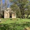
MAUSOLEA: mid 18th to mid 19th century, 3 adjoining rectangular-plan burial enclosures, arranged in L-plan, incorporating stonework of medieval Cambusnethan Parish Church. Ruinous and roofless.
S ENCLOSURE: mid 18th century, single storey, 3-bay, rectangular-plan, classical, Coltness mausoleum.
S (PRINCIPAL) ELEVATION: diagonally droved ashlar yellow sandstone. lugged, architraved and corniced doorway to centre, flanking blind windows, rope-moulded panel above inscribed 'Coltness', flanked by blind attic windows; ruinous gable; blank returns.
N ENCLOSURE: probably mid 19th century, single storey, 3-bay, rectangular-plan, Lockhart Mausoleum. Droved ashlar yellow sandstone.
E (PRINCIPAL) ELEVATION: wide central opening, flanking blind windows; blank returns. Ruinous above wallhead.
W ENCLOSURE: rectangular-plan, ruinous, base course only.
(Historic Environment Scotland List Entry)
Building Dates
Architects
Category of Risk and Development History
Condition
Very Poor
Category of Risk
High
Exemptions to State of Risk
Belhaven and Stenton Mausoleum is separate entry
Field Visits
14/04/2023
Development History
8 June 2021: Nominated by a member of the public.
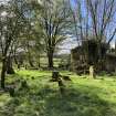
14 April 2023: Inspection finds that the churchyard does not appear to be maintained. Much of the remains of enclosures and mausolea are in ruinous condition, having suffered from collapse and stone loss. Many of the headstones are leaning or lying on the ground and partially buried. There is established vegetation growth on and around much of the remains of structures. Very little of the boundary wall remains. Move to At Risk.
Availability
Current Availability
Unknown
Appointed Agents
Price
Occupancy
Full
Occupancy Type
N/A
Present/Former Uses
Name of Owners
Unverified
Type of Ownership
Unknown
Information Services
Additional Contacts/Information Source
Bibliography
Online Resources
Classification
Cemeteries and Graveyards
Original Entry Date
09-JUN-21
Date of Last Edit
28/06/2023


