Notice
Following a review of the Buildings at Risk Register we have paused the Register while we consider options for its future.
The website will remain accessible and searchable during this time, but it will not be updated and we’re not accepting nominations for additions to the Register. If you need to contact us about the BARR please email hmenquiries@hes.scot
Read the review report here and you can find out more about why we have paused the BARR on our news centre.
Scar, Westove
Ordnance Survey licence number AC0000807262. All rights reserved. © Copyright and database right 2025. Public Sector Viewing Terms
Useful Links
- Canmore:
- SANDAY, SCAR STEADING, SCAR HOUSE
- Historic Scotland:
- HS Reference No 5908
General Details and Location
Category
AT RISK
Name of Building
Scar
Other Name(s)
Address
Westove
Locality
Postcode
Planning Authority
Divisional Area
Reference No
1512
Listing Category
B
OS Grid Ref
HY 67072 45115
Location Type
Rural
HS Reference No
5908
Description
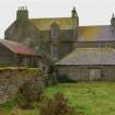
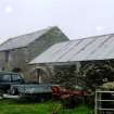
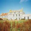
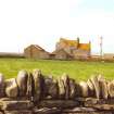
Extensive farm complex comprising 2-storey and dormered attic, 4-bay L-plan house, (later, single storey former schoolroom adjoined to SE) with lower, 2- and single-storey, crowstepped-gabled adjoining range projecting to NW, with terminating threshing mill, accompanying boiler house and chimney; lectern doocot disposed at right angles; further byre/store/cartshed ranges, forming farm courtyard with yard entrance to NE range; parallel ranges of single storey byres/sheds to centre of courtyard; large walled garden to NE of main house, (NW wall forming SE range of farm yard); single storey, complex-plan farm cottage to SE of main house, early 19th century core with later extensions.
A large, self contained farm complex, important for its size and range of facilities. The long SW range includes a threshing mill and boiler house as well as a doocot, which provided an important source of winter meat. The 2-storey block which immediately adjoins the house was possibly a former smithy, the basement containing a very large furnace with hand-operated bellows, still in working order. The late 19th/early 20th century saw a schoolroom added to the south end of the house with a good boarded interior. The farm had been established by the 17th century and took over an entire township (Marwick); it was the seat of the Traills of Westove. The factor, James Scarth, occupied the house before it passed to George Horwood in the later 19th century. (Historic Scotland)
A large, self contained farm complex, important for its size and range of facilities. The long SW range includes a threshing mill and boiler house as well as a doocot, which provided an important source of winter meat. The 2-storey block which immediately adjoins the house was possibly a former smithy, the basement containing a very large furnace with hand-operated bellows, still in working order. The late 19th/early 20th century saw a schoolroom added to the south end of the house with a good boarded interior. The farm had been established by the 17th century and took over an entire township (Marwick); it was the seat of the Traills of Westove. The factor, James Scarth, occupied the house before it passed to George Horwood in the later 19th century. (Historic Scotland)
Building Dates
Early 19th century
Architects
Unknown
Category of Risk and Development History
Condition
Fair
Category of Risk
High
Exemptions to State of Risk
Field Visits
Date unknown, Date unknown
Development History
September 1996: SCT receives information from the owner that the farmhouse has been empty since 1994, and on the market since 1991. October 1997: The steading is reported to be in worsening condition, with extensive renovation required. SCT understands that the house has recently been sold separately from the other steading buildings. 1999: Local planners report that no approaches have as yet been made to Orkney Islands Council concerning renovation or conversion.
December 2008: Orkney Council forward recent images of the complex.
May 2010: A member of the public contacts SCT advising the property is understood to have been purchased and possibly under restoration.
18 February 2015: A member of the public advises the property remains At Risk with broken window glazings.
20 July 2020: The property is under offer, through appointed agent Orkney Property Centre, having been marketed for sale at offers in the region of of £40,000.
Guides to Development
Conservation Area
Planning Authority Contact
PAC Telephone Number
01856 873535
Availability
Current Availability
Not Available
Appointed Agents
Price
Occupancy
Vacant
Occupancy Type
N/A
Present/Former Uses
BARR original text : Farm/Steading to School/College/University, Building Uses Information:
Present Use 1: N/A Former Use 1: Farm/Steading
Present Use 2: N/A Former Use 2: N/A, BARR original text : School/College/University to Residential
Present Use 1: N/A Former Use 1: Farm/Steading
Present Use 2: N/A Former Use 2: N/A, BARR original text : School/College/University to Residential
Name of Owners
Unverified see FAQ on ascertaining ownership
Type of Ownership
Private
Information Services
Additional Contacts/Information Source
http://orkneypropertycentre.co.uk/properties/scar-house-sanday-kw17-2az/
Bibliography
Burgher (1991), pp90-91; Gifford (1992), p357; Hume (1976-1977), vol. II, pp249-250; Robertson (1946).
Online Resources
Classification
Farming
Original Entry Date
20-OCT-97
Date of Last Edit
15/03/2022


