Ordnance Survey licence number AC0000807262. All rights reserved. © Copyright and database right 2024.
Useful Links
- Canmore:
- LUING, ACHAFOLLA MILL
- Historic Scotland:
- HS Reference No 47129
General Details and Location
Category
AT RISK
Name of Building
Achafolla Mill
Other Name(s)
Kilchattan Mill
Address
Toberonochy
Locality
Postcode
Planning Authority
Divisional Area
Reference No
1940
Listing Category
C
OS Grid Ref
NM 74283 10039
Location Type
Rural
HS Reference No
47129
Description
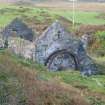
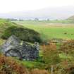
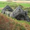
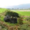
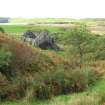
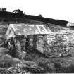
Single storey with attic, rectangular-plan former corn mill built into hillside with wheel in place to NE; roofless addition at rear forming near L-plan; remains of wall to N. Predominantly whinstone rubble (harled in part); rubble sandstone quoins in part to later wing. Glazing missing. Corrugated-iron roof to principal block (missing in part). INTERIOR: principal block with rubble walls; open timber ceiling with tie beams. Milling machinery in place to NE comprising timber-framed support with 2 pairs of stones (50in diameter), various cogs and wheels. Remains of metal roof supports in later addition.
A good example of a relatively rare building type, notable for the retention of its all-iron overshot wheel and the milling machinery. Hume notes that the construction of the wheel is unusual - there being 3 flat and 3 rod spokes on each side, with 6 cross-bracing spokes. Virtually all of the sheet-iron buckets have disappeared. Lade in place 1999. (Historic Environment Scotland List Entry)
A good example of a relatively rare building type, notable for the retention of its all-iron overshot wheel and the milling machinery. Hume notes that the construction of the wheel is unusual - there being 3 flat and 3 rod spokes on each side, with 6 cross-bracing spokes. Virtually all of the sheet-iron buckets have disappeared. Lade in place 1999. (Historic Environment Scotland List Entry)
Building Dates
Early-Mid 19th century
Architects
Unknown
Category of Risk and Development History
Condition
Ruinous
Category of Risk
Moderate
Exemptions to State of Risk
Field Visits
17/09/2009, 28/9/2012, 25/5/2017
Development History
November 1992: Members of the public report the mill to be ruinous, though partly roofed in corrugated iron. 1999: Outline permissions are sought for restoration as a dwelling. It is currently used as a cowshed but is being marketed. May 2000: The mill is C(S)-listed. February 2001: Local planners report that a detailed application has not yet been submitted. June 2006: Local planners report that following a recent site visit it was noted that there are signs of collapse where window openings are weak with the weight of the roof putting stress on the wall head. The Isle of Luing Community Trust have discussed purchase with the owner.
September 2009: External inspection finds the former mill, now a charming ruin, decaying slowly. Most of the associated ponds, lades and wheels remain intact. Potential for restoration remains.
28 September 2012: External inspection finds no significant change from the previous site visit.
25 May 2017: External inspection finds the building remains in much the same condition as seen previously: subject to slow general decline.
5 January 2023: A member of the public advises the former mill has recently been marketed for sale as a development opportunity. A plot adjacent, once the smiddy, is also been marketed for sale.
Availability
Current Availability
Unknown
Appointed Agents
Price
Occupancy
Vacant
Occupancy Type
N/A
Present/Former Uses
Name of Owners
Unverified see FAQ on ascertaining ownership
Type of Ownership
Unknown
Information Services
Additional Contacts/Information Source
Bibliography
Ordnance Survey map, 1871-78 (evident, marked as 'corn mill'). Ordnance Survey map, 1900 (evident, marked as 'corn mill (disused)'). J R Hume THE INDUSTRIAL ARCHAEOLOGY OF SCOTLAND, Vol 2 (1977) pp165-166
Online Resources
Classification
Farming
Original Entry Date
11-NOV-92
Date of Last Edit
02/02/2024


