Notice
Following a review of the Buildings at Risk Register we have paused the Register while we consider options for its future.
The website will remain accessible and searchable during this time, but it will not be updated and we’re not accepting nominations for additions to the Register. If you need to contact us about the BARR please email hmenquiries@hes.scot
Read the review report here and you can find out more about why we have paused the BARR on our news centre.
Esperston Farmhouse, Temple
Ordnance Survey licence number AC0000807262. All rights reserved. © Copyright and database right 2025. Public Sector Viewing Terms
Useful Links
- Canmore:
- ESPERSTON FARMHOUSE
- Historic Scotland:
- HS Reference No 6644
General Details and Location
Category
AT RISK
Name of Building
Esperston Farmhouse
Other Name(s)
Address
Temple
Locality
Postcode
Planning Authority
Divisional Area
Reference No
2176
Listing Category
B
OS Grid Ref
NT 33776 56962
Location Type
Rural
HS Reference No
6644
Description
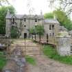
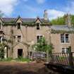
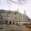
3 storey, 3 bay, rectangular plan farmhouse with 19th century additions and alterations. Harled with polished dressings. Dividing band course between ground and 1st floors; moulded eaves cornice; windows with raised margins; strip quoins; plain timber bargeboards. Predominantly 2 pane timber sash and case windows. Grey slate roof with lead ridge. Coped ashlar gablehead stacks with octagonal cans. Cast iron rainwater goods.
Writs for the lands of Esperston date back to the 14th century. The current house appears to have been constructed for the Arniston Estate in the mid 18th century. It was initially 2 storey. A stone in the garden records repairs of 1812, which is probably when the house was raised to accommodate a full attic storey and the porch was added. The 2 storey wing appears to date from the mid 19th century, contemporary with the addition of the bay windows and the enlarged 1st floor windows. The single storey service wing and rear lean to are later additions. (Historic Scotland)
Writs for the lands of Esperston date back to the 14th century. The current house appears to have been constructed for the Arniston Estate in the mid 18th century. It was initially 2 storey. A stone in the garden records repairs of 1812, which is probably when the house was raised to accommodate a full attic storey and the porch was added. The 2 storey wing appears to date from the mid 19th century, contemporary with the addition of the bay windows and the enlarged 1st floor windows. The single storey service wing and rear lean to are later additions. (Historic Scotland)
Building Dates
Mid 18th century; later additions and alterations
Architects
Unknown
Category of Risk and Development History
Condition
Very Poor
Category of Risk
Critical
Exemptions to State of Risk
Field Visits
01/03/2003, 21/05/2009, 29/5/2012, 17/03/2022
Development History
March 2003: External inspection reveals the house to be vacant, in a poor state of disrepair, and situated in the middle of a working farm. Guttering is severely blocked with vegetation, and many of the downpipes are broken. Some windows are smashed, whilst others stand open. Woodwork to the windows is rotten in places, whilst patches of harling have fallen from the front elevation. The house stands unsecured. SCT understands that the owner would be reluctant to sell the house due to its location within the farm.
May 2009: External inspection finds the building in very poor condition. The north-most bay is in danger of collapse above the first floor window. The gutters are completely overgrown, most glazing has been lost, as has the door, leading to water ingress and accelerated deterioration.
29 May 2012: External inspection finds no significant change from the previous site visit. Vegetation growths have increased and more render has been lost.
17 March 2022: External inspection finds that a section of the front elevation has collapsed and other parts of the elevation are at risk of collapse. Risk moved to CRITICAL due to the increased acceleration of deterioration due to the collapse and visible movement in the remaining structure.
Guides to Development
Conservation Area
Planning Authority Contact
PAC Telephone Number
0131 271 3302
Availability
Current Availability
Not Available
Appointed Agents
Price
Occupancy
Vacant
Occupancy Type
N/A
Present/Former Uses
Building Uses Information:
Present Use 1: N/A Former Use 1: Residential
Present Use 2: N/A Former Use 2: N/A
Present Use 1: N/A Former Use 1: Residential
Present Use 2: N/A Former Use 2: N/A
Name of Owners
Type of Ownership
Private
Information Services
Additional Contacts/Information Source
Bibliography
Online Resources
Classification
Middle-sized Houses
Original Entry Date
04-NOV-03
Date of Last Edit
29/03/2022


