Ordnance Survey licence number AC0000807262. All rights reserved. © Copyright and database right 2024.
Useful Links
General Details and Location
Category
AT RISK
Name of Building
Kennishead Farmhouse and Steading
Other Name(s)
Address
532, Kennishead Road, Glasgow
Locality
Postcode
Planning Authority
Divisional Area
Reference No
2682
Listing Category
Unlisted
OS Grid Ref
NS 54160 60319
Location Type
Urban
HS Reference No
Description
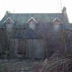
Farmhouse and steading in symmetrical U-plan lay-out, steading treated as flanking wings, outer ranges with gables to front (S) elevation; rubble-built, ashlar dressings, sash windows, slate roofs. HOUSE is single storey and attic (perhaps single storey originally), 3 bays, attic windows break through eaves and have gabled dormer heads; modern porch to central door; broad eaves; end stacks. Single storey ranges link house with parallel outer STEADING ranges, these with windows at ground floor and at loft level. (Historic Environment Scotland List Entry)
Building Dates
Probably Mid 19th century incorporating earlier ranges
Architects
Unknown
Category of Risk and Development History
Condition
Ruinous
Category of Risk
High
Exemptions to State of Risk
Field Visits
March 2002
, December 2007, 18/7/2013, 01/06/2023
, December 2007, 18/7/2013, 01/06/2023
Development History
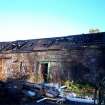
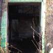
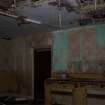
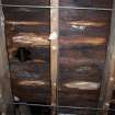
October 1999: local planners report that the farm has been vacant for 2 years and its condition is deteriorating. March 2002: External inspection reveals the farm to be in poor condition. December 2007: An inspection reveals the main farmhouse to be in very poor condition. There are slates missing and holes in the roof. The door is missing and the interior has been gutted and is now in very poor condition, the former contents of the house are scattered outside. The walls and ceilings are damp. The out buildings are ruinous with the roofs having largely collapsed.The secluded location close to main roads increases the risk of vandalism.
25 June 2012: A member of the public reports that all roofing is now gone and there is collapsed brickwork around the site.
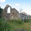
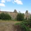
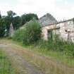
18 July 2013: External inspection the complex is now a ruinous shell with stonework slowly decaying. Parts of the site are now very overgrown.
17 January 2020: Local planners note following a re-assessment, the site has been de-listed. Record updated to note the complex is no longer C-listed.
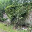
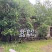
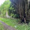
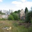
1 June 2023: External inspection finds the complex remains a roofless ruin. Since the previous site visit the buildings have been subject to increased vegetation growing in walls and the interiors. Only the north and west ranges could be assessed as the site is being engulfed by trees. There is widespread mortar loss and loose stones, some fallen into the southern range's interior. There is evidence of some fly-tipping and general vandalism around the site.
Guides to Development
Conservation Area
Pollok Park
Planning Authority Contact
PAC Telephone Number
0141 287 5492
Availability
Current Availability
Unknown
Appointed Agents
Price
Occupancy
Vacant
Occupancy Type
N/A
Present/Former Uses
Building Uses Information:
Present Use 1: N/A Former Use 1: Farm/Steading
Present Use 2: N/A Former Use 2: N/A
Present Use 1: N/A Former Use 1: Farm/Steading
Present Use 2: N/A Former Use 2: N/A
Name of Owners
Pollok and Corrour
Type of Ownership
Company
Information Services
Additional Contacts/Information Source
Bibliography
Online Resources
The Glasgow Story: http://www.theglasgowstory.com/image.php?inum=TGSH00022
Classification
Farming
Original Entry Date
10-OCT-99
Date of Last Edit
12/10/2023


