Ordnance Survey licence number AC0000807262. All rights reserved. © Copyright and database right 2024.
Useful Links
- Canmore:
- KILNMAICHLIE HOUSE
- Historic Scotland:
- HS Reference No 8474
General Details and Location
Category
AT RISK
Name of Building
Kilnmaichlie House & Gatepiers
Other Name(s)
Kilnmaichlie Tower
Address
Glenlivet
Locality
Postcode
Planning Authority
Divisional Area
Reference No
3633
Listing Category
B
OS Grid Ref
NJ 18133 32080
Location Type
Rural
HS Reference No
8474
Description
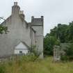
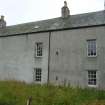
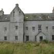
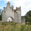
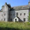
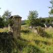
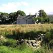
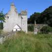
L-plan tower house extended later to N to form tall rectangular E facing dwelling with stair tower projecting off-centre in E front and terminating above wallhead in small caphouse. Modern grey harling; tooled granite margins and dressings. Original entrance blocked; present entrances in S gable and E front, both masked by late 19th century timber porches. Windows of varying size form regular pattern both front and rear; pair diminutive attic windows light caphouse of stair-tower; 3 small slit vents in rear; small attic light in each gable; 12-pane glazing. End stacks with circa 1700 copes; Banffshire slate roofs.
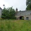
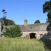
Crowstepped gables; mask skewput to caphouse, and also at SE angle just below wallhead. Early 19th century wing of 2 builds projects from N gable. Harled rubble with segmental headed archway; 2 doorways and irregular fenestration. (Some circa 1987)
Sir Walter Stewart held Kilnmaichlie in 1490 (great grandson of Robert II). The property was subdivided into two farm cottages in the 18th century through to the 1980s, as part of the Ballindalloch estate. (Historic Scotland).
Building Dates
Late 16th century with later additions.
Architects
Category of Risk and Development History
Condition
Fair
Category of Risk
Moderate
Exemptions to State of Risk
Field Visits
08/09/2008, 11/9/2012, 18/8/2015
Development History
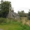
September 2008: External inspection finds the main tower house in fair condition but may be deteriorating as the structure appears to be in limited use. The single storey 19th century wing and gatepiers, are in poor condition. The building is understood to have been re-harled in the 1980s.
11 September 2012: External inspection finds no significant change from the previous site visit.
18 August 2015: External inspection finds the building remains in much the same condition as seen previously. Rainwater goods are partly chocked to the front elevation with vegetation and a glazing to one of the rooflights is missing.
4 March 2024: Desk-based assessment suggests the building remains disused.
Guides to Development
Conservation Area
Planning Authority Contact
PAC Telephone Number
01343 563270
Availability
Current Availability
Unknown
Appointed Agents
Price
Occupancy
Unknown
Occupancy Type
N/A
Present/Former Uses
Name of Owners
Unverified see FAQ on ascertaining ownership
Type of Ownership
Private
Information Services
Additional Contacts/Information Source
Bibliography
MacGibbon and Ross, THE CASTELLATED AND DOMESTIC ARCHITECTURE OF SCOTLAND vi (1892), pp. 128-9. Victor Gaffney, TOMINTOUL ITS GLENS AND ITS PEOPLE (1970), p. 40
Online Resources
Classification
Castles, Palaces and Fortified Houses
Original Entry Date
22-SEP-08
Date of Last Edit
30/12/2015


