Notice
Following a review of the Buildings at Risk Register we have paused the Register while we consider options for its future.
The website will remain accessible and searchable during this time, but it will not be updated and we’re not accepting nominations for additions to the Register. If you need to contact us about the BARR please email hmenquiries@hes.scot
Read the review report here and you can find out more about why we have paused the BARR on our news centre.
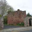
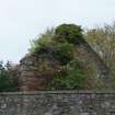
Fisher‘s Tower, Tower Road, Darnick
Ordnance Survey licence number AC0000807262. All rights reserved. © Copyright and database right 2025. Public Sector Viewing Terms
Useful Links
- Canmore:
- DARNICK, TOWER ROAD, FISHER'S TOWER
- Historic Scotland:
- HS Reference No 37757
General Details and Location
Category
AT RISK
Name of Building
Fisher‘s Tower
Other Name(s)
Address
Tower Road, Darnick
Locality
Postcode
Planning Authority
Divisional Area
Reference No
3835
Listing Category
B
OS Grid Ref
NT 53204 34339
Location Type
Small Town
HS Reference No
37757
Description
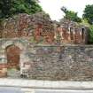
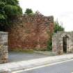
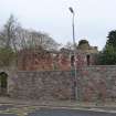
Rectangular roofless structure of 16th and 17th century origin, remodelled in 18th century as a two-storey house. North and south walls and east gable stand to near full height. West Gable is ruinous. North side, central entrance with monogram HW on lintel. 2 small windows, those at centre and left of 18th century date, that to the left of 16th century date, lengthened in 18th century. (Historic Environment Scotland List Entry)
Building Dates
16th/17th century; remodelled 18th century
Architects
Unknown
Category of Risk and Development History
Condition
Ruinous
Category of Risk
Low
Exemptions to State of Risk
Field Visits
27/04/2009, 21/07/2011, 3/8/2016
Development History
April 2009: External inspection reveals that the building is a ruinous shell. Some of the wallhead masonry has been lost and the building is at risk of further deterioration due to the unconsolidated nature of the rubblework.
July 2011: External inspection finds no significant change from the previous site visit.
3 August 2016: External inspection finds the building appears to remain relatively stable.
Guides to Development
Conservation Area
Darnick
Planning Authority Contact
PAC Telephone Number
Availability
Current Availability
Unknown
Appointed Agents
Price
Occupancy
Vacant
Occupancy Type
N/A
Present/Former Uses
Name of Owners
Unverified see FAQ on ascertaining ownership
Type of Ownership
Unknown
Information Services
Additional Contacts/Information Source
Bibliography
Royal Commission on the Ancient Monuments of Scotland, ROXBURGHSHIRE, ii 298; Alexander Jeffrey THE HISORY AND ANTIQUITIES OF ROXBURGHSHIRE, iv (1864), 69. Strang, C. 'Borders and Berwick' 1994, p.182.
Online Resources
Classification
Middle-sized Houses
Original Entry Date
13-MAR-09
Date of Last Edit
10/02/2017


