Notice
Following a review of the Buildings at Risk Register we have paused the Register while we consider options for its future.
The website will remain accessible and searchable during this time, but it will not be updated and we’re not accepting nominations for additions to the Register. If you need to contact us about the BARR please email hmenquiries@hes.scot
Read the review report here and you can find out more about why we have paused the BARR on our news centre.
Sornhill Farmsteading, Sornhill
Ordnance Survey licence number AC0000807262. All rights reserved. © Copyright and database right 2025. Public Sector Viewing Terms
Useful Links
- Canmore:
- SORNHILL
- Historic Scotland:
- HS Reference No 13829
General Details and Location
Category
AT RISK
Name of Building
Sornhill Farmsteading
Other Name(s)
Address
Sornhill
Locality
Postcode
Planning Authority
Divisional Area
Reference No
5928
Listing Category
A
OS Grid Ref
NS 50885 34151
Location Type
Rural
HS Reference No
13829
Description
Range of late 18th century byres adjoin (house); symmetrical facade to rear; recessed triple panels and palladian motif. (Historic Scotland)
Building Dates
Late 18th century
Architects
Category of Risk and Development History
Condition
Poor
Category of Risk
Low
Exemptions to State of Risk
The associated farm house is not At Risk.
Field Visits
22/10/2014
Development History
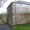
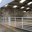
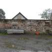
14 October 2014: External inspection finds the steading buildings in overall poor condition. Walls are of varying construction and the wall to the South has a noted lean to it. Rainwater goods are mostly missing or decayed. Roofs have generally been well maintained or consolidated. Listed Building Consent for conversion of the buildings to form holiday accomodation was lodged but withdrawn Jan 2014 ref: 12/0149/LB .
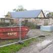
1 November 2021: Planning permission (17/1108/PP) and listed building consent (19/0126/LB) for change of use of agricultural byre to form residential holiday let with new roofs, extension and demolition works plus erection of new storage sheds with associated access and parking conditionally approved.
Availability
Current Availability
Unknown
Appointed Agents
Price
Occupancy
Vacant
Occupancy Type
Present/Former Uses
Name of Owners
Unverified see FAQ on ascertaining ownership
Type of Ownership
Unknown
Information Services
Additional Contacts/Information Source
Bibliography
Online Resources
Classification
Farming
Original Entry Date
29-JAN-15
Date of Last Edit
04/02/2015


