Notice
Following a review of the Buildings at Risk Register we have paused the Register while we consider options for its future.
The website will remain accessible and searchable during this time, but it will not be updated and we’re not accepting nominations for additions to the Register. If you need to contact us about the BARR please email hmenquiries@hes.scot
Read the review report here and you can find out more about why we have paused the BARR on our news centre.
Wylie's Mill, Mill Street, Drummore
Ordnance Survey licence number AC0000807262. All rights reserved. © Copyright and database right 2025. Public Sector Viewing Terms
Useful Links
- Canmore:
- DRUMMORE, MILL STREET, WYLLIE'S MILL
- Historic Scotland:
- HS Reference No 10089
General Details and Location
Category
AT RISK
Name of Building
Wylie's Mill
Other Name(s)
Alex Scott and Son (Former); James Wylie and Sons (Former); Wyllie's Mill
Address
Mill Street, Drummore
Locality
Postcode
Planning Authority
Divisional Area
Reference No
1516
Listing Category
C
OS Grid Ref
NX 13676 36707
Location Type
Rural Settlement
HS Reference No
10089
Description
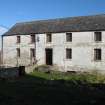
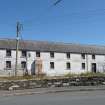
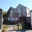
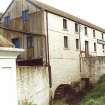
2-storey and basement former mill; full-height basement to N. Painted brick; painted rubble at basement to W elevation. Painted raised brick quoins and quoined margins. Shallow segmental lintels. Purple slates. Coped skews to S.
The building is prominently sited at the foot of Mill Street. The former listing for "Wylie's Corn Mill" actually referred to Drummore Mill, which was situated midway up Mill Street, and was demolished in the 1970s. Donnachie and Hume date this building as mid 19th century, although it is not actually marked on the OS Map of 1848; it is marked on the OS Map of 1906, but it is not shaded in, indicating that it was possibly either in ruins or in process of being built. The rubble basement suggests that the foundations of the earlier building were used in the current build. The floors and cast-iron uprights are said to have come from a building used in an exhibition in Glasgow about the turn of the 20th century. Although known as Wylie's Mill, the building has apparently always been used as a grain store; the water-wheel was used to power a grain bruiser and grain dresser. Wylie's Mill is named after a former owner. (Historic Scotland)
The building is prominently sited at the foot of Mill Street. The former listing for "Wylie's Corn Mill" actually referred to Drummore Mill, which was situated midway up Mill Street, and was demolished in the 1970s. Donnachie and Hume date this building as mid 19th century, although it is not actually marked on the OS Map of 1848; it is marked on the OS Map of 1906, but it is not shaded in, indicating that it was possibly either in ruins or in process of being built. The rubble basement suggests that the foundations of the earlier building were used in the current build. The floors and cast-iron uprights are said to have come from a building used in an exhibition in Glasgow about the turn of the 20th century. Although known as Wylie's Mill, the building has apparently always been used as a grain store; the water-wheel was used to power a grain bruiser and grain dresser. Wylie's Mill is named after a former owner. (Historic Scotland)
Building Dates
circa 1906, incorp foundations of post 1848 building
Architects
Unknown
Category of Risk and Development History
Condition
Fair
Category of Risk
Moderate
Exemptions to State of Risk
Field Visits
September 1994, January 2000, 26/07/2011, 27/2/2014
Development History
September 1994: Local planners ask for the building to be placed on the Buildings at Risk Register. External inspection reveals the property to be in limited use by Alex Scott and Son Hauliers. April 1995: The company reports that it wishes to part demolish and alter the building and erect a small workshop or garage. It is intended to retain the wheel. November 1996: An application is lodged for part demolition. March 1998: Solway Heritage reports that it has been in discussions with the owner concerning the partial demolition and rebuild of the building as part of an environmental improvement scheme for the harbour area. No viable projects resulted. January 2000: External inspection reveals the building to still stand. January 2002: SCT understands that sketches have been prepared for the conversion of the building into a house. The building has been sold. May 2002: The property is sold. May 2005: The new owners report that they are hoping to convert the property for residential use.
July 2011: External inspection finds no significant change from the previous site visit.
27 February 2014: External inspection finds the buildings remain in much the same condition as seen previously.
8 May 2018: The site is being marked for sale through auction by Future Property Auctions at a guide price of £95,000.
1 August 2024: Listed Building Consent for external repairs including re-roofing, and installation of new support beams has been conditionally approved (23/1009/LBC). Full Planning Permission for alteration, extension and change of use into flats and a house is being sought (24/0516/FUL).
Guides to Development
Conservation Area
Planning Authority Contact
PAC Telephone Number
01387 260199
Availability
Current Availability
Not Available
Appointed Agents
Price
Occupancy
Vacant
Occupancy Type
N/A
Present/Former Uses
Building Uses Information:
Present Use 1: N/A Former Use 1: Warehouse/Store
Present Use 2: N/A Former Use 2: N/A
Present Use 1: N/A Former Use 1: Warehouse/Store
Present Use 2: N/A Former Use 2: N/A
Name of Owners
Type of Ownership
Private
Information Services
Additional Contacts/Information Source
Bibliography
Donnachie (1971), p202; Hume (1976-1977), vol. I, p266; Hume (2000), p217.
Online Resources
Classification
Storage Buildings
Original Entry Date
06-DEC-94
Date of Last Edit
03/06/2021


