Notice
Following a review of the Buildings at Risk Register we have paused the Register while we consider options for its future.
The website will remain accessible and searchable during this time, but it will not be updated and we’re not accepting nominations for additions to the Register. If you need to contact us about the BARR please email hmenquiries@hes.scot
Read the review report here and you can find out more about why we have paused the BARR on our news centre.
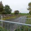
Lugar Bridge, Over Lugar Water, Ochiltree
Ordnance Survey licence number AC0000807262. All rights reserved. © Copyright and database right 2025. Public Sector Viewing Terms
Useful Links
- Canmore:
- OCHILTREE, LUGAR WATER, LUGAR BRIDGE
- Historic Scotland:
- HS Reference No 14322
General Details and Location
Category
AT RISK
Name of Building
Lugar Bridge
Other Name(s)
Old Lugar Bridge
Address
Over Lugar Water, Ochiltree
Locality
Postcode
Planning Authority
Divisional Area
Reference No
2786
Listing Category
B
OS Grid Ref
NS 51136 21406
Location Type
Urban
HS Reference No
14322
Description
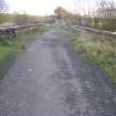
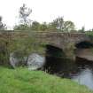
2 flat segmental arches in coursed rough-hewn pink stone. The central features a splayed cutwater. The bridge carries the former line of the B7036 public road between Ochiltree and Auchinleck.
Building Dates
Early 19th century
Architects
Unknown
Category of Risk and Development History
Condition
Poor
Category of Risk
Moderate
Exemptions to State of Risk
Field Visits
09/10/2009, 29/10/2014
Development History
1985: Strathclyde Regional Council seeks demolition consent. 30 May 1991: The Cumnock Chronicle reports that farmers G. and G. Templeton and J. Howatt are seeking permission to demolish. SCT and the Architectural Heritage Society of Scotland have both objected. 22 August 1991: The Cumnock Chronicle reports that councillors have refused demolition consent. Repairs are estimated at £33,750.
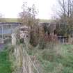
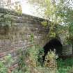
October 2009: Inspection finds the bridge in a neglected state. Several trees and large saplings are growing from the masonry.
29 October 2014: Inspection finds some works have taken place to restrict some of the vegetation growth to the bridge, otherwise it remains in much the same condition as seen previously.
Availability
Current Availability
Unknown
Appointed Agents
Price
Occupancy
Part
Occupancy Type
Public User
Present/Former Uses
Name of Owners
Type of Ownership
Company
Information Services
Additional Contacts/Information Source
Bibliography
Close, R. Ayrshire and Arran, (RIAS, 1992), p.143.
Online Resources
Classification
Roads and Paths
Original Entry Date
30-MAY-91
Date of Last Edit
17/03/2015


