Notice
Following a review of the Buildings at Risk Register we have paused the Register while we consider options for its future.
Read the review report here and you can find out more about why we have paused the BARR on our news centre.
Please be advised that this website will undergo scheduled maintenance on the following dates:
• Every Thursday from 17th October until 7th November from 11:00 to 15:00
• Tuesday, 22nd October from 11:00 to 15:00
During these times, some services may be temporarily unavailable. We apologise for any inconvenience this may cause.
Agricultural Range, Main Street, Kippen
Ordnance Survey licence number AC0000807262. All rights reserved. © Copyright and database right 2024. Public Sector Viewing Terms
Useful Links
General Details and Location
Category
AT RISK
Name of Building
Agricultural Range
Other Name(s)
Yard and Buildings
Address
Main Street, Kippen
Locality
Postcode
Planning Authority
Divisional Area
Reference No
3988
Listing Category
Unlisted
OS Grid Ref
NS 65056 94761
Location Type
Small Town
HS Reference No
Description
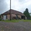
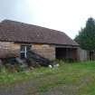
19th century brick range built for either ancillary or agricultural purposes. The southern section of the range features a hipped pantiled roof while the northern section is monopitch and covered with corrugated iron. The layout comprises a store at the south end followed by five cartshed openings.
Appears on the 2nd edition (1:2;500 series) OS map, but not the first.
Appears on the 2nd edition (1:2;500 series) OS map, but not the first.
Building Dates
19th century
Architects
Unknown
Category of Risk and Development History
Condition
Poor
Category of Risk
Critical
Exemptions to State of Risk
Field Visits
18/06/2009, 17/9/2012, 26/6/2015
Development History
June 2009: External inspection suggests that the structure is in use as a store. The corrugated section of the roof appears to be in poor condition and the doors, windows and timber lintels are in a state of decay. The upper sash of one of the windows has fallen out of its case.
17 September 2012: External inspection finds no significant change from the previous site visit.
11 December 2012: Full demolition application in favour of new build residential dwellings has been lodged with Stirling Council ref: 12/692/CON & 12/00691/FUL. Risk level moved to High.
21 June 2015: External inspection finds the building remains in much the same condition as seen previously. Full Planning Permission and Conservation Area Consent for the demolition of the building and replacement with 3 dwellings were conditionally approved Mar 2013 ref: 12/692/CON & 12/00691/FUL. Risk level raised to Critical.
10 March 2016: Renewal of Conservation Area Consent for demolition of the buildings is being sought ref: 16/00073/CON.
22 March 2018: Full Planning Permission and Conservation Area Consent for the demolition of the building and replacement with two dwellings are being sought ref: 18/00121/FUL & 18/00122/CON.
27 April 2020: Conservation Area Consent (20/00225/CON) being sought for demolition of existing redundant workshop and ruinous walls.
Guides to Development
Conservation Area
Kippen
Planning Authority Contact
PAC Telephone Number
01786 443407
Availability
Current Availability
Unknown
Appointed Agents
Price
Occupancy
Part
Occupancy Type
N/A
Present/Former Uses
BARR original text : Warehouse/Store to Farm/Steading
Name of Owners
Unverified see FAQ on ascertaining ownership
Type of Ownership
Unknown
Information Services
Additional Contacts/Information Source
Bibliography
Online Resources
Classification
Farming
Original Entry Date
23-JUN-09
Date of Last Edit
22/03/2018


