Ordnance Survey licence number AC0000807262. All rights reserved. © Copyright and database right 2024.
Useful Links
- Canmore:
- BO'NESS, CHURCH WYND, CHURCHYARDS
- Historic Scotland:
- HS Reference No 22350
General Details and Location
Category
AT RISK
Name of Building
Lower Church Wynd Graveyard
Other Name(s)
Address
Church Wynd, Bo'ness
Locality
Postcode
Planning Authority
Divisional Area
Reference No
6007
Listing Category
A
OS Grid Ref
NS 99710 81476
Location Type
Urban
HS Reference No
22350
Description
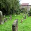
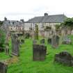
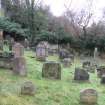
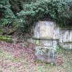
Stepped ashlar-coped rubble enclosing walls to E (Upper) and W (Lower) of Church Wynd. Many finely carved 17th and 18th century headstones, some re-used in 19th century, and mural monuments.
The graveyards flanking Church Wynd originally formed the burying ground of the former Bo'ness Old Kirk. The shore road often flooded at 'Corbie's Point', so Church Wynd was built during the 18th century at the Duke of Hamilton's request. The subsequent division of the burying ground led to the custom for people from Bo'ness to be buried in the Lower (W) ground and those from the Kinneil Estate in the Upper (E) ground. Owing to the parish church at Kinneil being some distance from the expanding seaport of Ness, a church was built at Corbiehall in 1634. The congregations were served by the minister from Kinneil until 1649 when Bo'ness was erected into a full charge. In 1669 an Act was passed declaring the church to be the 'Kirk of the Barony of Kinneil and Borrowstouness'. This Act suppressed the church of Kinneil and its parish and tiends were transferred to Bo'ness. The Duke of Hamilton added an aisle in 1672, the church was rebuilt in 1775 and again in 1820. Sold to the Episcopal Church in 1887, and subsequently to a private company, the building was converted to the Star Cinema by Matthew Steele in 1915, with the addition of an early Modern Movement façade. By 1964 the building was in use as a bingo hall, and was sold for conversion to a store and private dwelling during the 1990s. Category changed from B to A, 31 March 2004
The graveyards flanking Church Wynd originally formed the burying ground of the former Bo'ness Old Kirk. The shore road often flooded at 'Corbie's Point', so Church Wynd was built during the 18th century at the Duke of Hamilton's request. The subsequent division of the burying ground led to the custom for people from Bo'ness to be buried in the Lower (W) ground and those from the Kinneil Estate in the Upper (E) ground. Owing to the parish church at Kinneil being some distance from the expanding seaport of Ness, a church was built at Corbiehall in 1634. The congregations were served by the minister from Kinneil until 1649 when Bo'ness was erected into a full charge. In 1669 an Act was passed declaring the church to be the 'Kirk of the Barony of Kinneil and Borrowstouness'. This Act suppressed the church of Kinneil and its parish and tiends were transferred to Bo'ness. The Duke of Hamilton added an aisle in 1672, the church was rebuilt in 1775 and again in 1820. Sold to the Episcopal Church in 1887, and subsequently to a private company, the building was converted to the Star Cinema by Matthew Steele in 1915, with the addition of an early Modern Movement façade. By 1964 the building was in use as a bingo hall, and was sold for conversion to a store and private dwelling during the 1990s. Category changed from B to A, 31 March 2004
Building Dates
Late 17th century and later
Architects
Category of Risk and Development History
Condition
Poor
Category of Risk
Moderate
Exemptions to State of Risk
Risk record applies to lower graveyard only.
Field Visits
27/1/2015, 11/09/2019
Development History
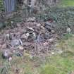
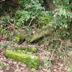
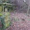
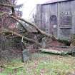
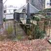
27 January 2015: Inspection finds the extensive areas of decay, with some areas of collapse, to the east internal graveyard wall containing funeray monuments. Many grave markers are badly damaged, ivy covers large sections of funerary monuments and grave markers towards the outer cemetary. Fallen trees have broken further grave markers and remaining standing trees may require attention to ensure they do not threaten further gravemarkers. Boundary walls are sound but the entrance railings are very decayed and damaged.
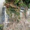
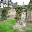
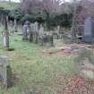
11 September 2019: Site visit reveals that many grave markers remain in fair condition and the grass surrounding them is being maintained. The boundary wall to NE & SW with grave markers set into, or immediately adjacent to, are being encroached by tree and ivy growth, with masonry being disrupted as a result. Some markers are now entirely engulfed by ivy. Risk level moved to Moderate.
Guides to Development
Conservation Area
Bo'ness Town Centre
Planning Authority Contact
PAC Telephone Number
01324 504715
Availability
Current Availability
Not Available
Appointed Agents
Price
Occupancy
Vacant
Occupancy Type
Present/Former Uses
Name of Owners
Type of Ownership
Unknown
Information Services
Additional Contacts/Information Source
Bibliography
Online Resources
Classification
Cemeteries and Graveyards
Original Entry Date
19-MAY-15
Date of Last Edit
03/10/2019


