Ordnance Survey licence number AC0000807262. All rights reserved. © Copyright and database right 2024.
Useful Links
- Canmore:
- DUNBAR, 102 HIGH STREET, CLOSE
- Historic Scotland:
- HS Reference No 24818
General Details and Location
Category
AT RISK
Name of Building
Range to Rear, 100 High Street
Other Name(s)
Close of 102 High Street
Address
High Street, Dunbar
Locality
Postcode
Planning Authority
Divisional Area
Reference No
6288
Listing Category
B
OS Grid Ref
NT 67869 78955
Location Type
Urban
HS Reference No
24818
Description
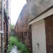
A row of 3, 2-storey houses. Rendered sandstone rubble. Chamfered openings. Thick walls, bowing in places. Openings uneven, 1st floor windows under eaves. Some remaining small-pane glazing; many blocked.
Rear walls on close 106. (Historic Environment Scotland List Entry)
Rear walls on close 106. (Historic Environment Scotland List Entry)
Building Dates
17th century (possibly 1st half).
Architects
Category of Risk and Development History
Condition
Very Poor
Category of Risk
High
Exemptions to State of Risk
Field Visits
07 June 2019
Development History
12 March 2019: Nominated for the Register by local planners as a range of disused buildings to the rear of the High Street. Thought to have been latterly in use as storage buildings. For Investigation.
7 June 2019: External inspection finds that skews are damaged and plant growth visible. Rainwater goods are damanged and choaked with plants. Walls are unsabled - showing a pronounced bow. Windows and doors are damaged and blocked. Close is locked and overgrown.
Guides to Development
Conservation Area
Dunbar
Planning Authority Contact
PAC Telephone Number
01620 827264
Availability
Current Availability
Unknown
Appointed Agents
Price
Occupancy
Vacant
Occupancy Type
N/A
Present/Former Uses
Name of Owners
Type of Ownership
Information Services
Additional Contacts/Information Source
Bibliography
Online Resources
Classification
Terraced Housing
Original Entry Date
12-MAR-19
Date of Last Edit
13/11/2019


