Ordnance Survey licence number AC0000807262. All rights reserved. © Copyright and database right 2024.
Useful Links
- Canmore:
- SANDAY, BACKASKAILL MAINS
- Historic Scotland:
- HS Reference No 46401
General Details and Location
Category
AT RISK
Name of Building
Backaskaill Mains
Other Name(s)
Backaskaill Steading
Address
Sanday
Locality
Postcode
Planning Authority
Divisional Area
Reference No
952
Listing Category
B
OS Grid Ref
HY 64188 39298
Location Type
Rural
HS Reference No
46401
Description
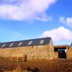
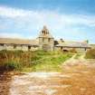
Steading court with a central pyramid-roofed tower over a wide segmental-arched pend, flanked by single storey ranges in rubble and slate. The complex incorporates a threshing barn that retains the largest water wheel in Orkney.
Building Dates
19th century
Architects
Unknown
Category of Risk and Development History
Condition
Poor
Category of Risk
High
Exemptions to State of Risk
The adjacent farmhouse is not at risk.
Field Visits
September 1998, September 1998
Development History
September 1998: External inspection reveals the steading to be in a poor state, with several holes in the roof. November 2000: SCT receives information that a local group of Islanders has plans to convert the steading into a farm museum. Funding sources are being investigated. 29 April 2004: The Orcadian reports on the property's inclusion in the Buildings at Risk Bulletin 2004-2005.
December 2008: Orkney Council forward recent images of the steading.
January 2009: Local planners report that discussions relating to recent works undertaken are ongoing.
5 March 2024: Desk-based assessment suggests building remains At-Risk.
Guides to Development
Conservation Area
Planning Authority Contact
PAC Telephone Number
01856 873535
Availability
Current Availability
Unknown
Appointed Agents
Price
Occupancy
Unknown
Occupancy Type
Unknown
Present/Former Uses
Building Uses Information:
Present Use 1: N/A Former Use 1: Farm/Steading
Present Use 2: N/A Former Use 2: N/A
Present Use 1: N/A Former Use 1: Farm/Steading
Present Use 2: N/A Former Use 2: N/A
Name of Owners
Type of Ownership
Private
Information Services
Additional Contacts/Information Source
Bibliography
OLD STATISTICAL ACCOUNT (1791); R O Pringle, ON THE AGRICULTURE OF THE ISLANDS OF ORKNEY, Transactions of the Highland and Agricultural Society, 4th series, 6, (1874), p 30; 1st edition Ordnance Survey map, (1881), evident; A Goodfellow, SANDAY CHURCH HISTORY (1912), p343; H Marwick, ORKNEY FARM NAMES (1952), p 17; P Bailey, ORKNEY, (1995), p63; RCAHMS, SCOTTISH FARM BUILDINGS SURVEY, VOL 2, ORKNEY (SANDAY), 1998, p14; ORKNEY ARCHIVES, KIRKWALL LIBRARY D2 50/17
Online Resources
Classification
Farming
Original Entry Date
15-SEP-98
Date of Last Edit
07/01/2021


