Ordnance Survey licence number AC0000807262. All rights reserved. © Copyright and database right 2024.
Useful Links
- Canmore:
- GLENOUR
- Historic Scotland:
- HS Reference No 6451
General Details and Location
Category
AT RISK
Name of Building
Glenour
Other Name(s)
Address
Colmonell
Locality
Postcode
Planning Authority
Divisional Area
Reference No
1103
Listing Category
B
OS Grid Ref
NX 17277 83109
Location Type
Rural
HS Reference No
6451
Description
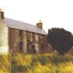
2-storey, 3-bay traditional farmhouse. Harled, ashalr cills. 4-pane glazing in sash and case windows. Ashlar skews to porch. Coped harled gablehead stacks. Thackstanes. Small grey slates.
The building is unoccupied and in a poor state of repair (1990). (Historic Scotland)
The building is unoccupied and in a poor state of repair (1990). (Historic Scotland)
Building Dates
Late 18th century
Architects
Unknown
Category of Risk and Development History
Condition
Very Poor
Category of Risk
High
Exemptions to State of Risk
Field Visits
September 1992, 17/9/2014
Development History
September 1995: SCT receives news of a proposed Northern Ireland power line to run at the rear of the building, which could compromise its setting.
July 2002: SCT receives information that the property has been sold to a private purchaser.
June 2006: Owners confirm no change to information held on the Register.
July 2002: SCT receives information that the property has been sold to a private purchaser.
June 2006: Owners confirm no change to information held on the Register.
17 September 2014: Limited external inspection from a distance. Large trees have grown in close proximity to the farmhouse and damaged the roof . Gutters are clogged and roof slates are missing. The byre range is roofless.
Guides to Development
Conservation Area
Planning Authority Contact
PAC Telephone Number
01292 616352
Availability
Current Availability
Unknown
Appointed Agents
Price
Occupancy
Vacant
Occupancy Type
N/A
Present/Former Uses
Name of Owners
Type of Ownership
Private
Information Services
Additional Contacts/Information Source
Bibliography
Online Resources
Classification
Middle-sized Houses
Original Entry Date
25-SEP-92
Date of Last Edit
07/01/2021


