Ordnance Survey licence number AC0000807262. All rights reserved. © Copyright and database right 2024.
Useful Links
- Canmore:
- CASSENCARIE HOUSE
- Historic Scotland:
- HS Reference No 10106
General Details and Location
Category
AT RISK
Name of Building
Cassencarie House
Other Name(s)
Cassencarrie House; Cassencary House
Address
Kirkmabreck
Locality
Postcode
Planning Authority
Divisional Area
Reference No
1338
Listing Category
B
OS Grid Ref
NX 47613 57639
Location Type
Rural
HS Reference No
10106
Description
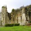
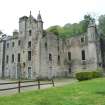
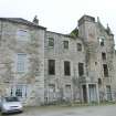
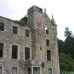
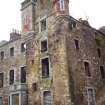
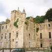
Mansion house comprised of 3 major building campaigns: late 16th to early 17th century L-plan 4-storey tower house, extended and re-faced in early 19th century (possibly 18th century) toform a symmetrical, calssical 3-storey, 5-bay house, and Baronialised in later 19th century with work including additional wing. Now largely roofless (1989). Earlier to mid 19th century, low 2-storey service wing added at NE corner, now the Laird's Inn, including adjoining bay at mansion house. Sited on high ground by Cree estuary.
The tower house was possibly built by the Muirs, properties of the lands from the 1580s (Stell). The armorial crest the motto of Sir James Caird, patron of the later 19th century Baronial work. Cassencarie is also referred to as Cassencary. A stable block converted as residential and with regrettable glazing and roofing, lies to N of the mansion house, E of the walled garden and is part of the Cassencarie Holiday Park, to be covered by curtilage. The walled garden currently serves as a putting green. (Historic Scotland)
The tower house was possibly built by the Muirs, properties of the lands from the 1580s (Stell). The armorial crest the motto of Sir James Caird, patron of the later 19th century Baronial work. Cassencarie is also referred to as Cassencary. A stable block converted as residential and with regrettable glazing and roofing, lies to N of the mansion house, E of the walled garden and is part of the Cassencarie Holiday Park, to be covered by curtilage. The walled garden currently serves as a putting green. (Historic Scotland)
Building Dates
Early 17th century; Early-Late 19th century
Architects
Unknown
Category of Risk and Development History
Condition
Ruinous
Category of Risk
Moderate
Exemptions to State of Risk
The north service wing operates as The Lairds Inn and is not at risk.
Field Visits
01/07/1990, 01/08/1995, 01/01/2001, 01/08/2009, 06/05/2011, 26/2/2014
Development History
July 1990: External inspection reveals the house to be a roofless shell, though the structure appears relatively stable. During the 1970s the tower house was roofed and used as a hay store, although the surrounding land now operates as the Castle Cary holiday park. January 2001: External inspection reveals that the shell remains in reasonable condition. January 2002: Local planners confirm ownership details.
August 2009: External inspection finds part of the building is still a roofless shell. Mature trees and vegetation are growing within the building and from the masonry.
May 2011: External inspection finds no significant change from the previous site visit.
26 February 2014: External inspection finds there has been a partial collapse of the South West wall since the previous visit. Risk level raised to Moderate.
Guides to Development
Conservation Area
Planning Authority Contact
PAC Telephone Number
01387 260199
Availability
Current Availability
Unknown
Appointed Agents
Price
Occupancy
Vacant
Occupancy Type
N/A
Present/Former Uses
Building Uses Information:
Present Use 1: N/A Former Use 1: Residential
Present Use 2: N/A Former Use 2: N/A
Present Use 1: N/A Former Use 1: Residential
Present Use 2: N/A Former Use 2: N/A
Name of Owners
Castle Cary Holiday Park
Type of Ownership
Company
Information Services
Additional Contacts/Information Source
Bibliography
Dean and Miers (1990), p43; Gifford (1996), p166; Hume (2000), p183.
Online Resources
Classification
Country Houses, Mansions and Large Villas
Original Entry Date
02-JUL-90
Date of Last Edit
23/07/2018


