Ordnance Survey licence number AC0000807262. All rights reserved. © Copyright and database right 2024.
Useful Links
- Canmore:
- SANDNESS, ST MARGARET'S KIRK AND GRAVEYARD, WAR MEMORIAL
- Historic Scotland:
- HS Reference No 18628
General Details and Location
Category
AT RISK
Name of Building
St Margaret's Kirk
Other Name(s)
Sandness Church
Address
Sandness
Locality
Postcode
Planning Authority
Divisional Area
Reference No
1877
Listing Category
B
OS Grid Ref
HU 19137 57642
Location Type
Rural
HS Reference No
18628
Description
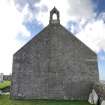
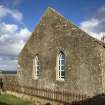
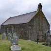
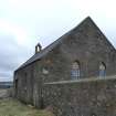
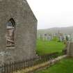
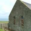
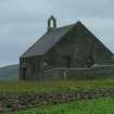
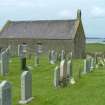
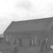
2 x 1-bay symmetrical hall church. Harled walls. Hoppered 9-pane timber windows flanking centre of S elevation. Cement-rendered infill to door centred in E gable; pointed-arched opening in gabled stugged ashlar bellcote at gablehead. 2-bay N elevation with 9-pane timber window in bay to right, modern 2-leaf doors inserted in bay to left. Border-glazed stained glazing to pointed-arched windows in 2-bay W gable. Purple-grey slate roof with harled skew copes. There is a stone on the east gable inscribed 'Fear God 1645'. (Historic Scotland).
Building Dates
1792
Architects
Unknown
Category of Risk and Development History
Condition
Fair
Category of Risk
Low
Exemptions to State of Risk
Field Visits
August 2000, 22/06/2006, 11/09/2008, 24/03/2010, 24/6/2014, 05/10/2022
Development History
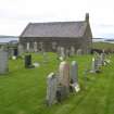
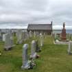
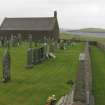
1996: The church is reported as vacant. August 2000: External inspection reveals the main door to be blocked up. Windows have been covered with corrugated iron sheeting. June 2006: External inspection reveals the building is still at risk, although the planning authority have confirmed that planning permission was granted to use the church as a sheep shed. The building is secure and surrounded on 3 sides by a well kept graveyard.
September 2008: External inspection finds the church in good condition but unused and sealed up.
March 2010: External inspection finds the church remains disused and boarded up. It's condition is beginning to deteriorate. A few slates have been lost from the roof and some repointing is required, especially on the south elevation. Since our previous visit the windows in the west elevation have been repaired. The graveyard wall, which is included in the listing, is currently being repaired, with the majority of the west wall having been taken down and new foundations laid.
24 June 2014: External inspection finds, other than minor slate loss, the building remains in much the same condition as seen previously.
5 October 2022: External inspection finds that some replacement works have been carried out to the windows on the South and West elevations. Roof and walls appear to be in much the same condition as noted in previous report. Unable to view North elevation, where access door is located. Building appears to possibly be used for storage.
Guides to Development
Conservation Area
Planning Authority Contact
PAC Telephone Number
01595 744762
Availability
Current Availability
Unknown
Appointed Agents
Price
Occupancy
Vacant
Occupancy Type
N/A
Present/Former Uses
BARR original text : Church/Convent/Monastery to Warehouse/Store, Building Uses Information:
Present Use 1: N/A Former Use 1: Church/Convent/Monastery
Present Use 2: N/A Former Use 2: N/A
Present Use 1: N/A Former Use 1: Church/Convent/Monastery
Present Use 2: N/A Former Use 2: N/A
Name of Owners
Type of Ownership
Private
Information Services
Additional Contacts/Information Source
Bibliography
Finnie (1990), p57; Gifford (1992), p497.
Online Resources
Classification
Churches and Chapels
Original Entry Date
01-FEB-99
Date of Last Edit
07/01/2021


