Ordnance Survey licence number AC0000807262. All rights reserved. © Copyright and database right 2024.
Useful Links
- Canmore:
- AUCHERNACH HOUSE, WALLED GARDEN
- Historic Scotland:
- HS Reference No 16199
General Details and Location
Category
AT RISK
Name of Building
Auchernach House Walled Garden
Other Name(s)
Address
Auchernach
Locality
Postcode
Planning Authority
Divisional Area
Reference No
2602
Listing Category
B
OS Grid Ref
NJ 33021 15982
Location Type
Rural
HS Reference No
16199
Description
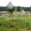
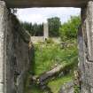
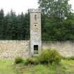
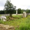
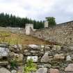
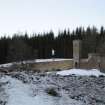
Outstanding large rectangular-plan walled garden with crenellated towers and centre terrace, sited on S facing slope behind former Auchernach House and overlooking Water of Nochty. Tall slim granite ashlar fronted tower with raised quoin strips and margins at centre of N wall; circular towers to centre of E and W walls; wall breached at SE. High flat-coped rubble walls partly harled. S elevation of N wall with centre steps up to door in 1st stage of square tower, 2nd stage with inscribed granite panel below panel formerly with clock and louvered opening above. Round towers also providing access to garden. Vaulted cellars (remains of early house) and remains of concrete arcade at ruinous S edge. Further wall extending to NW.
Although neglected, the Auchernach walled garden retains much of its outstanding original fabric. The garden stands on a prominent hillside and when glimpsed from the Glen Nochty road it gives the appearance of an Indian hill fort upon which it is believed to have been modelled. The garden was recently (2005) sold to a Strathdon resident who plans to restore it. Immediately to the north of the garden are the remains of holding ponds and sluices with contouring lades which held water from a spring approximately one mile away in the hills. The system worked until very recently when some piping was demolished corrupting the holding system. To the north west is the ruinous White Well, comprising a lined basin and alcoved seat of white quartz. It was known locally as Napoleon´s Well because a willow tree behind the seat was grown from a seed taken from a tree at Napoleon´s grave. In the late 1920s, the owner of Auchernach, G F Rose, organised a survey of the estate, the resulting publication, The Geology of Auchernach, describes the 12,000 acres as ´stern and bare´ with ´spacious and well-timbered policies, the quaint old house, and the ample walled garden stretching up the sunny slope behind´. From the later years of the 16th century until 1901, the estate belonged to the Forbes family of Skellater. Auchernach House (demolished 1945) and walled garden were built circa 1810 by Lieut-General Nathaniel Forbes, of the Honourable East India Company, the New Statistical Account reports that it was ´for many years the best in the country´. The house was built on the remains of an earlier building, described as an 'old castle´. The vaults at the southern edge of the garden are part of that original structure. In his introduction to The Geology of Auchernach W Douglas Simpson describes the walled garden as ´covering an area of about an acre. It is enclosed by a massive rubble-built wall, 20 or 25 feet in external height, with round battlemented towers midway in each front and a tall clock tower, likewise embattled, in the rear. The design is unusual and very striking. It is understood that General Forbes borrowed the idea from an Indian hill-fort. The clock in the tower is of curious mechanism, and is dated 1787: another inscription records that it was repaired in 1832, and it was overhauled again in 1929. Midway in its length the garden is terraced, and in the centre is a fountain. There is also a sun-dial bearing the date 1826 and the initials NF and SF, for Nathaniel Forbes and his wife& (Historic Scotland)
Although neglected, the Auchernach walled garden retains much of its outstanding original fabric. The garden stands on a prominent hillside and when glimpsed from the Glen Nochty road it gives the appearance of an Indian hill fort upon which it is believed to have been modelled. The garden was recently (2005) sold to a Strathdon resident who plans to restore it. Immediately to the north of the garden are the remains of holding ponds and sluices with contouring lades which held water from a spring approximately one mile away in the hills. The system worked until very recently when some piping was demolished corrupting the holding system. To the north west is the ruinous White Well, comprising a lined basin and alcoved seat of white quartz. It was known locally as Napoleon´s Well because a willow tree behind the seat was grown from a seed taken from a tree at Napoleon´s grave. In the late 1920s, the owner of Auchernach, G F Rose, organised a survey of the estate, the resulting publication, The Geology of Auchernach, describes the 12,000 acres as ´stern and bare´ with ´spacious and well-timbered policies, the quaint old house, and the ample walled garden stretching up the sunny slope behind´. From the later years of the 16th century until 1901, the estate belonged to the Forbes family of Skellater. Auchernach House (demolished 1945) and walled garden were built circa 1810 by Lieut-General Nathaniel Forbes, of the Honourable East India Company, the New Statistical Account reports that it was ´for many years the best in the country´. The house was built on the remains of an earlier building, described as an 'old castle´. The vaults at the southern edge of the garden are part of that original structure. In his introduction to The Geology of Auchernach W Douglas Simpson describes the walled garden as ´covering an area of about an acre. It is enclosed by a massive rubble-built wall, 20 or 25 feet in external height, with round battlemented towers midway in each front and a tall clock tower, likewise embattled, in the rear. The design is unusual and very striking. It is understood that General Forbes borrowed the idea from an Indian hill-fort. The clock in the tower is of curious mechanism, and is dated 1787: another inscription records that it was repaired in 1832, and it was overhauled again in 1929. Midway in its length the garden is terraced, and in the centre is a fountain. There is also a sun-dial bearing the date 1826 and the initials NF and SF, for Nathaniel Forbes and his wife& (Historic Scotland)
Building Dates
Circa 1810
Architects
Unknown
Category of Risk and Development History
Condition
Very Poor
Category of Risk
High
Exemptions to State of Risk
Field Visits
11/01/2008, 18/08/2010
Development History
November 2002: Local planners refuse permissions for a new-build house within the walled garden due to a lack of guarantees that the new-build will be linked to the restoration of the walled garden and doocot. 7 March 2003: The Donside Piper reports that a new application has been lodged, with the owner willing to enter into a legal agreement to ensure the restoration of the garden and doocot. Historic Scotland has approved the plans. However, there remain concerns the ability to raise the estimated £300,000 required. A decision has been deferred to allow the owner to submit detailed costings.
August 2007: Applications (ref: APP/2002/0020 & APP/2002/0021) for the erection of a dwellinghouse were withdrawn August 2007)
January 2008: External inspection reveals part of the wall to the SE is collapsed. The masonry is in very poor condition and urgently needs repointing alongwith the consolidation of the collapsed SE section of wall.
August 2010: External inspection finds the walled garden in fair condition is some areas, but poor in others. Repair works were being undertaken at the time of inspection.
7 August 2013: External inspection finds the building to remain in much the same condition as the last site visit. Some localised works have started installing precast concrete cope stones and repairing walls.
Guides to Development
Conservation Area
Planning Authority Contact
PAC Telephone Number
01467 620981
Availability
Current Availability
Unknown
Appointed Agents
Price
Occupancy
Vacant
Occupancy Type
N/A
Present/Former Uses
Building Uses Information:
Present Use 1: N/A Former Use 1: Walled Garden
Present Use 2: N/A Former Use 2: N/A
Present Use 1: N/A Former Use 1: Walled Garden
Present Use 2: N/A Former Use 2: N/A
Name of Owners
Unverified see FAQ on ascertaining ownership
Type of Ownership
Unknown
Information Services
Additional Contacts/Information Source
Bibliography
Shepherd, I [A G] (1994 a) Gordon: an illustrated architectural guide, [Edinburgh], 66, Shepherd, I A G (2006 ) Aberdeenshire, Donside and Strathbogie: an illustrated architectural guide, Charles McKean, [Edinburgh], 66,
Online Resources
Glenbuchat Heritage: http://www.glenbuchatheritage.com/picture/number384.asp
Classification
Ancillary Buildings
Original Entry Date
07-MAR-03
Date of Last Edit
23/07/2018


