Ordnance Survey licence number AC0000807262. All rights reserved. © Copyright and database right 2024.
Useful Links
- Canmore:
- CASTLECARY, BRIDGE
- Historic Scotland:
- HS Reference No 6682
General Details and Location
Category
AT RISK
Name of Building
Putlock Bridge
Other Name(s)
Castlecary Bridge; Roman Bridge
Address
Over Red Burn, Castlecary
Locality
Postcode
Planning Authority
Divisional Area
Reference No
2796
Listing Category
C
OS Grid Ref
NS 78752 78231
Location Type
Urban
HS Reference No
6682
Description
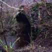
Single-span depressed-arch roadbridge in tooled and margined sandstone ashlar. Putlock holes sit at the springing point of the intrados.
The bridge was erected as part of the Glasgow to Bo'ness turnpike road, lying nearby the location that the Roman military way crossed the Red Burn near to the Antonine Wall. (Historical Cumbernauld)
The bridge was erected as part of the Glasgow to Bo'ness turnpike road, lying nearby the location that the Roman military way crossed the Red Burn near to the Antonine Wall. (Historical Cumbernauld)
Building Dates
18th century
Architects
Unknown
Category of Risk and Development History
Condition
Ruinous
Category of Risk
Critical
Exemptions to State of Risk
Field Visits
07/02/2008, 27/05/2010, 11/11/2014
Development History
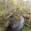
June 1994: Historic Scotland reports that the bridge is collapsing in places, revealing its rubble core. It sits directly below the Castlecary Railway Viaduct and is no longer used as a roadbridge. The wings walls have been reduced and the road surface is overgrown.
February 2008: Site visit reveals little of the bridge survives other than the arch and part of the core. The bridge is overgrown with moss and grass. There is evidence that stones have fallen from the abutment.
2 July 2008: The Kilsyth Chronicle reports that North Lanarkshire council planning officials confirm that they will co-operate with Historic Scotland and neighbouring authorities to carry out any necessary restoration or preservation work on the bridge.
1 August 2008: The Cumbernauld & Kilsyth Advertiser and the Cumbernauld News report that the council are assessing repair needs and the impact of the A80 upgrade on the bridge.
13 May 2009: Cumbernauld News reports that Transport Scotland intends to carry out works to preserve the bridge during the upgrading of the A80.
May 2010: A site visit finds the location exceptionally overgrown to the point where it is not possible to comment on the condition of the bridge.
11 November 2014: Inspection finds the structure in much the same condition as seen previously.
Availability
Current Availability
Unknown
Appointed Agents
Price
Occupancy
Vacant
Occupancy Type
N/A
Present/Former Uses
Name of Owners
Unverified see FAQ on ascertaining ownership
Type of Ownership
Unknown
Information Services
Additional Contacts/Information Source
Bibliography
Historical Cumbernauld Cumbernauld Historical Society 1968 p 41
Online Resources
Classification
Roads and Paths
Original Entry Date
01-JUN-94
Date of Last Edit
04/08/2015


