Ordnance Survey licence number AC0000807262. All rights reserved. © Copyright and database right 2024.
Useful Links
- Canmore:
- STAXIGOE, GRANARIES
- Historic Scotland:
- HS Reference No 49297
General Details and Location
Category
AT RISK
Name of Building
Grain Store (Former)
Other Name(s)
Address
Elzy Road, Staxigoe
Locality
Postcode
Planning Authority
Divisional Area
Reference No
2906
Listing Category
B
OS Grid Ref
ND 38466 52431
Location Type
Rural Settlement
HS Reference No
49297
Description
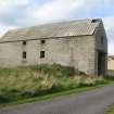
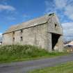
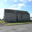
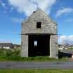
Large, simple, 2-storey and attic, 2-bay rectangular-plan grain store. Coursed Caithness stone. Modern corrugated asbestos roof.
The grain store was formerly part of a group of 3 grain stores situated directly above Staxigoe harbour. The other 2 grain stores (one of which was built as 2 houses in the late 19th century and converted to a grain store in the 20th century) were situated nearby to the NW, they were demolished in 2003.Although predominantly gutted and re-roofed in asbestos it is a large, impressive building with important historical and cultural associations to Staxigoe and the local area.
The 1865 New Statistical Account dates the 2 earlier grain stores buildings as early 17th century, however as J Hume points out it is more likely that they are 18th century. Staxigoe during the 18th and 19th century was a busy small port with the grain stores playing a fundamental role in the life of the village. The grain stores in the later 18th and early 19th century were owned by Alexander "Miller of the Field" a local entrepreneur and factor of the Hempriggs Estate. The above cited article in the Northern Ensign, 1869, documents his life and the importance the grain mills played within the area. Farmers and crofters often paid part of their rents in kind with grain, it would be ground and bagged at nearby Papigoe and then transported and stored at Staxigoe awaiting shipment. In times of scarcity of grain, people would travel to Staxigoe from as far as Sutherland to purchase meal, indicating that the village was one of the primary grain repositories within Caithness. Alexander "Miller of the Field" can also be credited as one of the first to realise the potential of the herring market in the 1770s and 1780s, no doubt under his entrepreneurial guidance Staxigoe became a thriving fishing station in the 19th century. The natural harbour to the immediate NE of the grain store was improved in the early 19th century as a result of the boom in fishing with quay walls built to both sides of the haven.A photograph held by the Royal Commission for Ancient and Historical Monuments of Scotland (RCAHMS) shows the village in 1891, 2 grain stores are clearly decipherable with many other domestic buildings surrounding them. The photograph also shows many more openings to the SW elevation of the store. With the demise of the fishing industry and change in farming methods the village fell into decline in the early 20th century. There was a large programme of demolition in the inter-war period with people being re-housed in newly built council housing. The area above the harbour was flattened with only a few buildings and the grain stores left standing. With the demolition of 2 of the grain stores in 2003 the surviving grain store is a unique testimony to the history of the village and a reminder of past agricultural practises.
It should be noted that in 2003 RCAHMS surveyed all 3 grain stores and found carpentry marks (Roman Numerals) in the roof timbers of the older grain stores. (Historic Scotland)
Building Dates
18th century
Architects
Unknown
Category of Risk and Development History
Condition
Poor
Category of Risk
Low
Exemptions to State of Risk
Field Visits
20/6/2012, 27/9/2013
Development History
24 October 2003: The John O'Groats Journal reports that permission is beign sought to demolish. 11 letters of objection have already been received. For investigation
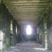
20 June 2012: External inspection finds the building is a roofed shell. The windows and doors have been lost. The roof itself is in poor condition with holes on both pitches. The interior is home to a flock of pigeons. Listed Building Consent for full demolition was refused Mar 2004 ref: 03/00440/LBCCA and April 2007 06/00469/LBCCA. Full Planning Permission and Listed Building Consent for conversion and alteration to form dwelling were conditionally approved May 2011 ref: 11/00029/FUL & 11/00030/LBC.
27 September 2013: External inspection finds the building remains in much the same condition as seen previously.
23 February 2024: Desk-based assessment suggests the building remains disused.
Availability
Current Availability
Unknown
Appointed Agents
Price
Occupancy
Vacant
Occupancy Type
N/A
Present/Former Uses
Name of Owners
Unverified see FAQ on ascertaining ownership
Type of Ownership
Unknown
Information Services
Additional Contacts/Information Source
Bibliography
Hume (1976-1977), vol. II, p199.
Online Resources
Highland HER: http://her.highland.gov.uk/SingleResult.aspx?uid=MHG2094
Classification
Storage Buildings
Original Entry Date
24-OCT-03
Date of Last Edit
09/07/2014


