Ordnance Survey licence number AC0000807262. All rights reserved. © Copyright and database right 2024.
Useful Links
- Canmore:
- LESSENDRUM, HOME FARM
- Historic Scotland:
- HS Reference No 50133
General Details and Location
Category
AT RISK
Name of Building
Lessendrum House Home Farm including Doocot
Other Name(s)
Address
Drumblade
Locality
Postcode
Planning Authority
Divisional Area
Reference No
3268
Listing Category
C
OS Grid Ref
NJ 5756 4144
Location Type
Rural
HS Reference No
50133
Description
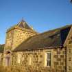
Single storey, 5-bay courtyard steading with centred 2-stage pavilion-roofed castellated dovecot pend entrance and balancing gabled bays. Squared and snecked rubble with contrasting ashlar dressings. Segmentally headed cart arches. Stone mullions. W (PRINCIPLE) ELEVATION: symmetrical. Entrance pend to centre bay with modern timber porch at 1st stage obscuring cart arch pend entrance, tripartite opening to 2nd stage with small circular opening above. 3 irregular window openings to flanking bays and additional outshot porch at left; outer gabled bays each with bipartite window. Free standing 3-bay piended cottage beyond right and further gable of later timber bay beyond to left. Multi-pane glazing patterns in timber sash and case windows. Grey slates. Overhanging eaves with plain bargeboarding.
Although Lessendrum Home Farm has been altered, the quality stonework and design of the front range is supported by lesser elevations which retain the character of a steading of the mid 19th century, and although the segmentally headed cart arches have been blocked, the work is reversible. The Bisset family were connected with Lessendrum estate from the 14th century until the 1960s even though nearby ruinous Lessendrum House, separately listed at category C(S), was destroyed by fire during the 1920s. Incorporating a 17th century house, it was reworked by Archibald Simpson in 1837. (Historic Scotland)
Although Lessendrum Home Farm has been altered, the quality stonework and design of the front range is supported by lesser elevations which retain the character of a steading of the mid 19th century, and although the segmentally headed cart arches have been blocked, the work is reversible. The Bisset family were connected with Lessendrum estate from the 14th century until the 1960s even though nearby ruinous Lessendrum House, separately listed at category C(S), was destroyed by fire during the 1920s. Incorporating a 17th century house, it was reworked by Archibald Simpson in 1837. (Historic Scotland)
Building Dates
Mid 19th century
Architects
Unknown
Category of Risk and Development History
Condition
Poor
Category of Risk
Moderate
Exemptions to State of Risk
Field Visits
December 2007, 16/10/2013
Development History
December 2007: External inspection reveals the building to be in poor condition; it appears to be unused and unmaintained. Although wind and water tight, the rainwater goods are defective.
July 2008: Huntly Express reports that planning permission has been granted for conversion of the Home Farm into 5 residential units and extend the South Lodge.
16 October 2013: External inspection finds the complex remains in much the same condition as seen previously. The wooden building at the western end is however collapsing.
12 May 2014: The steading is being marketed for sale as a development opportunity through appointed agents Burnett & Reid Llp at offers over £300,000.
1 March 2018: Burnet & Reid LLP's website notes the property has been sold.
28 September 2018: Full Planning Permission and Listed Building Consent for conversion and partial demolition to form a dwelling and a holiday let are being sought ref: No: APP/2018/2224 & APP/2018/2225.
19 May 2021: Consents for redevelopment, noted previously, were conditionally approved in 2018.
Guides to Development
Conservation Area
Planning Authority Contact
PAC Telephone Number
01467 620981
Availability
Current Availability
Not Available
Appointed Agents
Price
Occupancy
Vacant
Occupancy Type
N/A
Present/Former Uses
Building Uses Information:
Present Use 1: N/A Former Use 1: Farm/Steading
Present Use 2: N/A Former Use 2: N/A
Present Use 1: N/A Former Use 1: Farm/Steading
Present Use 2: N/A Former Use 2: N/A
Name of Owners
Unverified see FAQ on ascertaining ownership
Type of Ownership
Unknown
Information Services
Additional Contacts/Information Source
Bibliography
Ed H Hamilton THIRD STATISTICAL ACCOUNT (1960), p599. I Shepherd GORDON (1994), pp36-37.
Online Resources
Classification
Farming
Original Entry Date
08-JAN-08
Date of Last Edit
28/09/2018


