Ordnance Survey licence number AC0000807262. All rights reserved. © Copyright and database right 2024.
Useful Links
- Canmore:
- CASTLELAW
General Details and Location
Category
AT RISK
Name of Building
Castlelaw
Other Name(s)
The Castle
Address
Castlelaw Farm
Locality
Postcode
Planning Authority
Divisional Area
Reference No
3901
Listing Category
Unlisted
OS Grid Ref
NT 81208 41930
Location Type
Rural
HS Reference No
Description
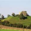
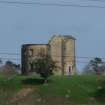
South West-facing single bow fronted two-storey building with a pitched roof, which has now almost entirely collapsed internally. There is evidence for a three-storey building visible on the SE-facing wall. The bow-fronted facade is in dressed sandstone with a stringcourse between the ground and first floors, stone sills and lintels to the windows. There are three bays; some with fragmentary remains of the sash and case frames parts of the wooden shutters survives. (RCAHMS)
Building Dates
Late 18th, early 19th century, possibly incorp earlier structure
Architects
Unknown
Category of Risk and Development History
Condition
Ruinous
Category of Risk
Low
Exemptions to State of Risk
Field Visits
28/09/2011, 08/04/2009
Development History
April 2009: External inspection reveals that only a section of the house survives, the remains of which is a ruinous shell.
April 2010: A member of the public contacts SCT to advise he had been advised by the current owners that they do not wish to sell the building at this time.
September 2011: External inspection finds no significant change from the previous site visit.
Guides to Development
Conservation Area
Planning Authority Contact
PAC Telephone Number
Availability
Current Availability
Not Available
Appointed Agents
Price
Occupancy
Vacant
Occupancy Type
N/A
Present/Former Uses
Name of Owners
Type of Ownership
Unknown
Information Services
Additional Contacts/Information Source
Bibliography
Online Resources
Classification
Country Houses, Mansions and Large Villas
Original Entry Date
16-APR-09
Date of Last Edit
21/03/2012


