Ordnance Survey licence number AC0000807262. All rights reserved. © Copyright and database right 2024.
Useful Links
- Canmore:
- NEWCASTLETON, 9 SOUTH LIDDLE STREET
General Details and Location
Category
AT RISK
Name of Building
Other Name(s)
Address
9, South Liddle Street, Newcastleton
Locality
Postcode
Planning Authority
Divisional Area
Reference No
3922
Listing Category
Unlisted
OS Grid Ref
NY 48390 87334
Location Type
Small Town
HS Reference No
Description
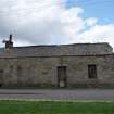
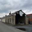
Three-bay, single storey, end terrace building of rubble construction. Pitched corrugated roof. Lack of windows to the street elevation suggest that the structure originally functioned as a workshop or smithy. Newcastleton is a planned village founded in 1793 by the Duke of Buccleuch. Appears on the 1st edition (1:2,500 series) map.
Building Dates
Unknown
Architects
Unknown
Category of Risk and Development History
Condition
Poor
Category of Risk
Low
Exemptions to State of Risk
Field Visits
03/08/2011, 29/04/2009
Development History
April 2009: External inspection suggests that the building is in use as a garage as the north east gable wall has been largely removed to allow vehicular access. The rubblework displays deep open joints and appears damp at the base. Sections of the roof ridge are missing and the timber doors to the street elevation appear damp and decayed.
August 2011: External inspection finds no significant change from the previous site visit.
Guides to Development
Conservation Area
Newcastleton
Planning Authority Contact
PAC Telephone Number
Availability
Current Availability
Unknown
Appointed Agents
Price
Occupancy
Full
Occupancy Type
Unknown
Present/Former Uses
BARR original text : Smithy to Garage
Name of Owners
Type of Ownership
Unknown
Information Services
Additional Contacts/Information Source
Bibliography
Online Resources
Classification
Ancillary Buildings
Original Entry Date
07-MAY-09
Date of Last Edit
16/11/2011


