Ordnance Survey licence number AC0000807262. All rights reserved. © Copyright and database right 2024.
Useful Links
- Canmore:
- BUTE, ST COLMAC'S CHURCH
- Historic Scotland:
- HS Reference No 18283
General Details and Location
Category
AT RISK
Name of Building
St Colmac's Church
Other Name(s)
Address
St Colmac
Locality
Postcode
Planning Authority
Divisional Area
Reference No
4319
Listing Category
C
OS Grid Ref
NS 05324 67337
Location Type
Rural
HS Reference No
18283
Description
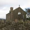
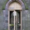
Symmetrical 2-stage, 3- by 3-bay plain gothic style church with 3-stage square-plan belfry tower centred in 'nave-and-aisles' gable to E. Harl-pointed rubble sandstone; pink sandstone dressings; coursed sandstone ashlar tower. Raised base course; moulded string course to tower; corniced eaves; polished blocking course. Narrow strip quoins; droved pink rubble sandstone quoins; droved pink rubble long and short surrounds to polished, pointed-arched openings; chamfered reveals; chamfered cills; sandstone mullions; architraved hoodmoulds. Boarded, Tudor-arched openings at ground in bays flanking centre. Predominantly opaque glazing (part missing). Original stained glass window to W. Roof missing; replacement rainwater goods.
Photographs held in the NMRS show an unusual interior arrangement with a full length common communion table running E-W down the centre of the church flanked by timber pews. Box pews, facing W lined the side aisles. According to the SVBWG Handbook, the unusual communion table was formed, when necessary, by the conversion of pew ends. The photographs also show a timber panelled gallery situated to the E and a timber panelled pulpit to the W. Despite the church's state of disrepair, the graveyard, boundary walls, gatepiers and gates remain remarkably intact. The building of both the church and the nearby manse (not listed) is thought to have been by Paterson of Largs to a cost of £6,000. (Historic Scotland)
Photographs held in the NMRS show an unusual interior arrangement with a full length common communion table running E-W down the centre of the church flanked by timber pews. Box pews, facing W lined the side aisles. According to the SVBWG Handbook, the unusual communion table was formed, when necessary, by the conversion of pew ends. The photographs also show a timber panelled gallery situated to the E and a timber panelled pulpit to the W. Despite the church's state of disrepair, the graveyard, boundary walls, gatepiers and gates remain remarkably intact. The building of both the church and the nearby manse (not listed) is thought to have been by Paterson of Largs to a cost of £6,000. (Historic Scotland)
Building Dates
Dated 1835
Architects
Probably Paterson of Largs
Category of Risk and Development History
Condition
Ruinous
Category of Risk
Moderate
Exemptions to State of Risk
Field Visits
02/12/2009
Development History
December 2009: External inspection finds the church to be a roofless shell in a well maintained graveyard. This building will continue to deteriorate unless remedial action is taken. Listed building consent for change of use of the building into a dwelling house was lodged, but later withdrawn in 2007 ref: 07/00398/LIB.
29 August 2012: External inspection finds no significant change from the previous site visit.
Availability
Current Availability
Unknown
Appointed Agents
Price
Occupancy
Vacant
Occupancy Type
N/A
Present/Former Uses
Name of Owners
Type of Ownership
Unknown
Information Services
Additional Contacts/Information Source
Bibliography
Appears on Ordnance Survey map, 1863; G Hay THE ARCHITECTURE OF SCOTTISH POST REFORMATION CHURCHES 1560 - 1843 (1952) p182, 189, 252; Revd. A S Borrowman THE PARISH OF NORTH BUTE (1962); J MacCallum "WISH YOU WERE HERE": A PICTURE POSTCARD VIEW OF EDWARDIAN BUTE p56; F Walker & F Sinclair NORTH CLYDE ESTUARY: AN ILLUSTRATED ARCHITECTURAL GUIDE (1992) p164; "WISH YOU WERE HERE" SVBWG Handbook (1995) p13; photographic records NMRS BU/658, BU/660, BU/663, BU/666, BU/668, BU/669, BU/670, BU/671, BU/672, BU/673.
Online Resources
Classification
Churches and Chapels
Original Entry Date
17-DEC-09
Date of Last Edit
23/11/2012


