Ordnance Survey licence number AC0000807262. All rights reserved. © Copyright and database right 2024.
Useful Links
- Canmore:
- BUTE, ROTHESAY, 61 HIGH STREET
- Historic Scotland:
- HS Reference No 40457
General Details and Location
Category
AT RISK
Name of Building
Other Name(s)
Address
61-67, High Street, Rothesay
Locality
Postcode
Planning Authority
Divisional Area
Reference No
5446
Listing Category
B
OS Grid Ref
NS 08843 64497
Location Type
Urban
HS Reference No
40457
Description
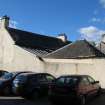
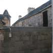
Symmetrical pair of 2-storey, 3-bay cottages forming low rectangular-plan terrace with shops at ground. Painted harl; painted margins; overhanging eaves. Pitched single storey, rectangular-plan, part whitewashed random rubble outbuilding at rear (No 65).
Previously listed as No 67 High Street and shop premises of Dugald H McFie; also shop plumbers. No 65 at rear owned by Bute Estate Office and leased to Nos 61 and 67 (building contractors). Formerly random rubble.
Rothesay is one of Scotland's premier seaside resorts, developed primarily during the second half of the 19th and early 20th centuries, and incorporates an earlier medieval settlement. The town retains a wide range of buildings characteristic of its development as a high status 19th century holiday resort, including a range of fine villas, a Victorian pier and promenade.
The history and development of Rothesay is defined by two major phases. The development of the medieval town, centred on Rothesay Castle, and the later 19th and early 20th century development of the town as a seaside resort. Buildings from this later development, reflect the wealth of the town during its heyday as a tourist destination, and include a range of domestic and commercial architecture of a scale sometimes found in larger burghs. Both the 19th and early 20th century growth of the town, with a particular flourish during the inter-war period, included areas of reclaimed foreshore, particularly along the coast to the east of the town and around the pier and pleasure gardens.
(List description revised as part of Rothesay listing review 2010-11). (Historic Scotland)
Building Dates
Circa 1820
Architects
Unknown
Category of Risk and Development History
Condition
Fair
Category of Risk
Low
Exemptions to State of Risk
Field Visits
30/8/2012
Development History
30 August 2012: External inspection finds the building is generally sound with a roof that is very poor in places - many missing, broken or slipped slates particularly to the outbuilding to rear. Gutters and rainwater pipes to rear are in poor condition. Only one section of the building appears to be in active use, the rest is disused.
31 May 2016: Listed Building Consent for external repairs and some demolition of later rear extensions is being sought with a view to enabling the full re-use of the site ref: 16/00873/LIB.
15 May 2017: Listed Building Consent for alterations to form a residential education centre is being sought ref: 17/00897/LIB.
Availability
Current Availability
Not Available
Appointed Agents
Price
Occupancy
Part
Occupancy Type
Unknown
Present/Former Uses
Name of Owners
Type of Ownership
Unknown
Information Services
Additional Contacts/Information Source
Bibliography
Online Resources
Classification
Terraced Housing
Original Entry Date
06-DEC-12
Date of Last Edit
31/05/2016


